name
rundanuyi is named after its discoverer, lakamura rundanu, combined with the suffix -yi from the waptokan word meaning "land".
geography
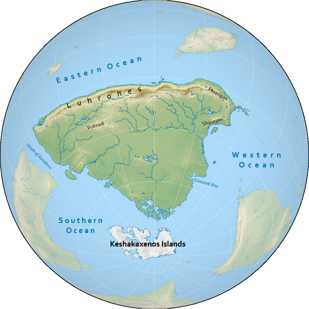
rundanuyi is the largest continent on notasami at 34 million square kilometres. much of the continent is surrounded by the southern ocean, bounded by the eastern and western oceans to the north, separated from rundanuyi by the strait of rundanu.
climate
the climate of rundanuyi ranges mostly from arid to subarctic.
the northern half of rundanuyi is arid, interrupted by the luhrohes mountains creating some temperate areas.
the southern half is more humid and subarctic, with tundra on the southern coast. the kešakaxenos archipelago is covered in ice caps.
the eastern coast is more humid than the western coast, and is also more temperate.
countries & territories
| flag | name | population | area |
|---|---|---|---|
| beniras | 11,049,602 | 5,400,265 km² | |
| cošan | 820,078 | 535,674 km² | |
| gimorek | 117,796,701 | 7,966,315 km² | |
| pluznipin | 34,725,149 | 1,000,290 km² | |
| širurpin | 159,307,084 | 1,486,011 km² | |
| šonsanisyi | 140,332 | 299,349 km² | |
| (tbd) | - | - |
history
the history of rundanuyi is usually divided into the following periods:
- prehistory: before -500
- bronze age: -500 to 320
- iron age: 320 to 870
- mesne period: 870 to 1700
- early modern period: 1700 to 2050
- modern period: 2050 to 2300
- interstellar period: 2300 to present
the earliest traces of agrarian societies on rundanuyi can be found around nibon, dating back to around -9000. sites in mesneyi date back as far as -7000. a prehistoric agrarian society in vulmidi that peaked around -5000, which left behind several complex grave sites, appears to have influenced many cultures along the luhrohes range, before the spread of terenism.
this age is known primarily for the kingdom of nibon, which came to rule over much of the northwestern coast.
this era is usually centered around the two so-called "interior empires", ksutka and koshanar in chronological order.
this period sees the rise of the rancherugre and the westward spread of terenism. while the rancherugre fragmented after a century and a half, its successor states were not particularly hostile with each other and terenic influence was maintained.
this period sees first the emergence of the duska empire, and then colonisation from emiheg. colonisation was relatively gradual on rundanuyi until about 1950, in part due to the duska adopting an anti-imperialist stance, which in turn further cemented the duska as the regional hegemon. eventually the duska empire collapsed and rundanuyi was colonised more thoroughly.
this age sees the colonies of rundanuyi gain independence from the empires of emiheg, some through struggle, and some peacefully.
this recently-defined period starts with the discovery of interstellar travel and examines the role of the countries of rundanuyi in the now accessible interstellar domain.
demographics
languages
there are four main language families native to rundanuyi; from west to east these are: fimbian, vulmidian, ustauniskan, and the mesne languages. in the southern half of the continent anachek dominates as the most widely spoken language, though many minority languages are still spoken. it is estimated that there are some 240 languages spoken in rundanuyi.
religion
the northern part of rundanuyi mostly adheres to terenism, owing to the influence of the rancherugre. the south, which experienced extensive settler colonialism, is consequently mostly bunapunist. some traditional indigenous faiths and some newer indigenous faiths syncretic with bunapunism and/or terenism are also practiced, albeit in the minority.
population
the most populous country in rundanuyi is shirurpin with almost 160 million people. most countries in rundanuyi have populations over 1 million people, and two countries have more than 100 million people, the other being gimorek. šonsanisyi is the least populous country on notasami, with a population of 140 thousand people.
the largest metropolitan areas in rundanuyi include kanamga, yuncu, and šinkoraš. the three of these have populations exceeding 10 million people, making them megacities, and ten more have more than 5 million people.
